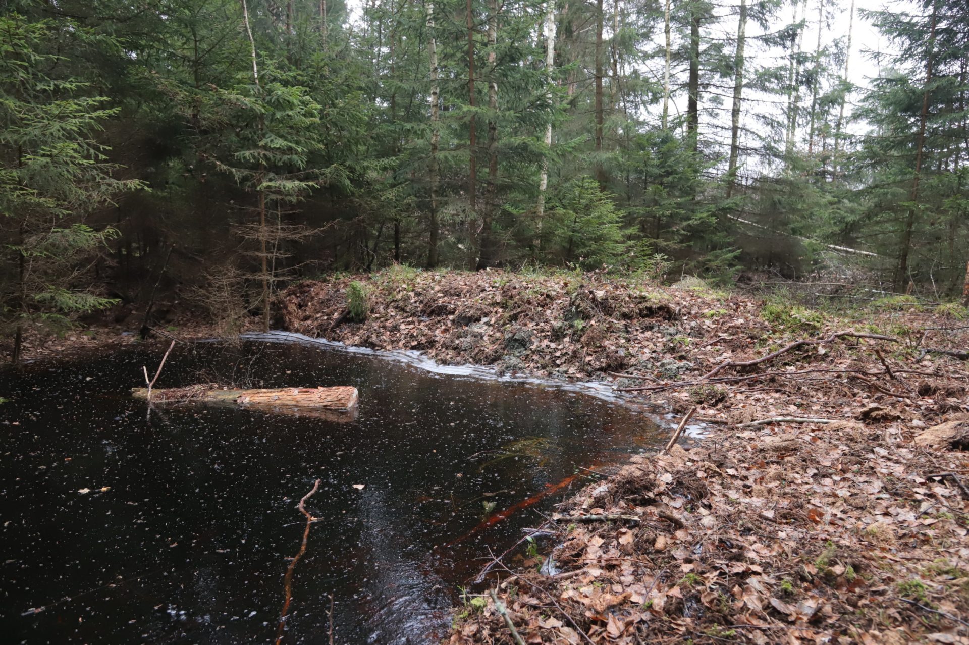
To stabilize water level and restore environment for mire vegetation development, dam building was completed in November 2020 in all three Latvian project sites. Within the framework of LIFE Peat Restore project, 36 dams were built. As a result peatland hydrology will be stabilized in the total area of 274.4 ha in three mires – Madiešēnu Mire in Augstroze Nature Reserve, Baltezers Mire and fens in Engure Lake Nature Park. Positive tendencies in water level rise in drainage ditches and peat top layer moistening were observed already after few months after dam building in Madiešēnu Mire and Baltezers Mire.
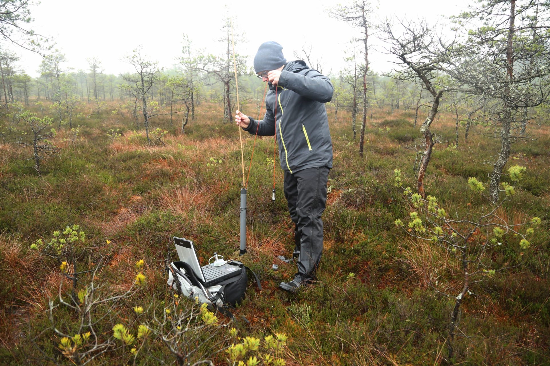
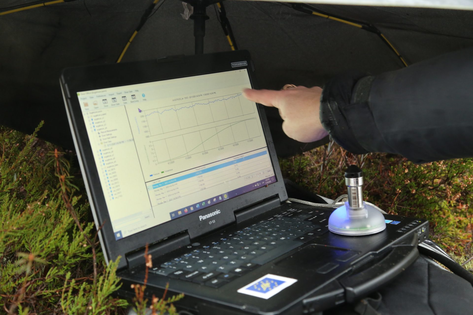
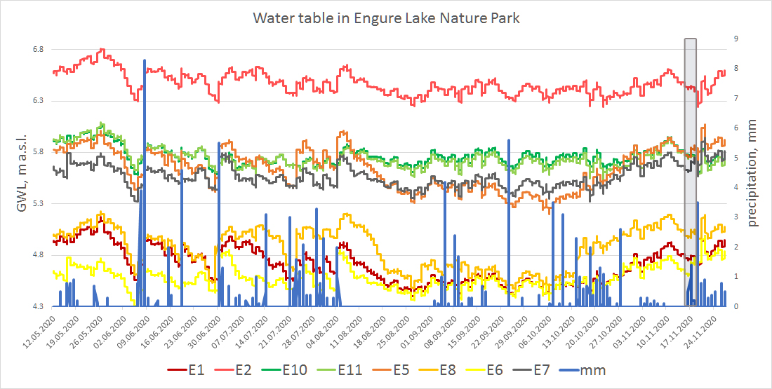
To follow the restoration success, so far only water level monitoring data were analysed. For this reason monitoring wells with automatic data loggers were installed in each project site already in April 2018. Vegetation monitoring will proceed in spring 2021 as soon as active plant growth season begins.
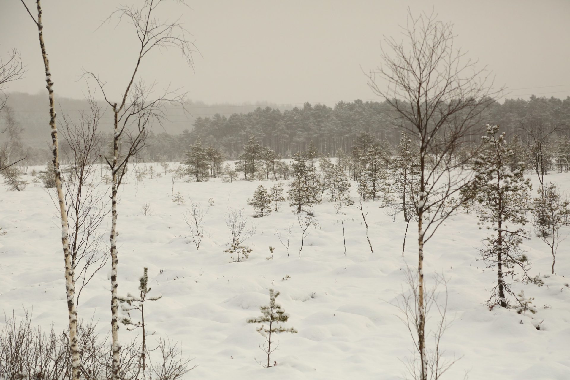
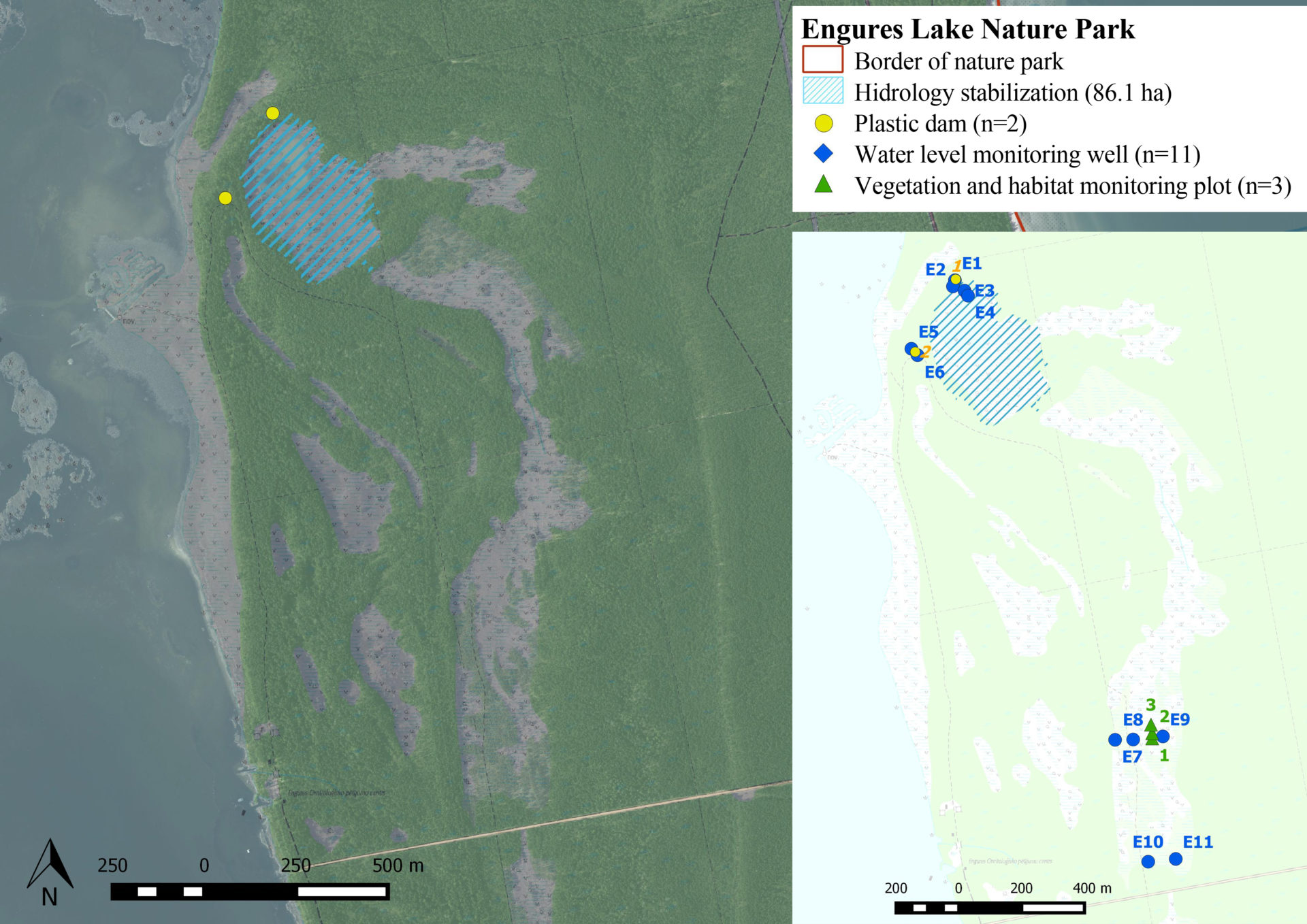
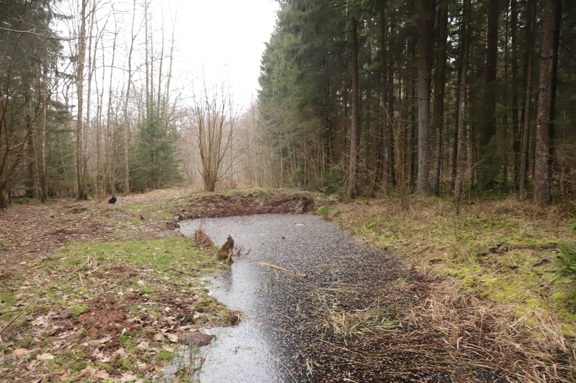
Northern part of Madiešēnu Mire was drained in time period from 1983 to 1998. To restore the degraded area around ditches in total area of 147.8 ha, 26 peat dams were built. Water level monitoring is carried out in nine wells that are located in three transects with different distance from ditches. Drainage in Baltezers Mire Nature Reserve was processed more than 100 years ago. To prevent a further degradation of mire habitat, eight peat dams were built. Modelled hydrology stabilization area reaches to 40.5 ha. Nine water level monitoring wells are used to follow the success of restoration. Calcareous fens in Engure Lake Nature Park have developed in previous lake area after water lowering and are gradually overgrowing with shrubs. Two plastic dams were installed to restore the fens in total area of 86.1 ha. Water level monitoring is carried out in eleven wells.
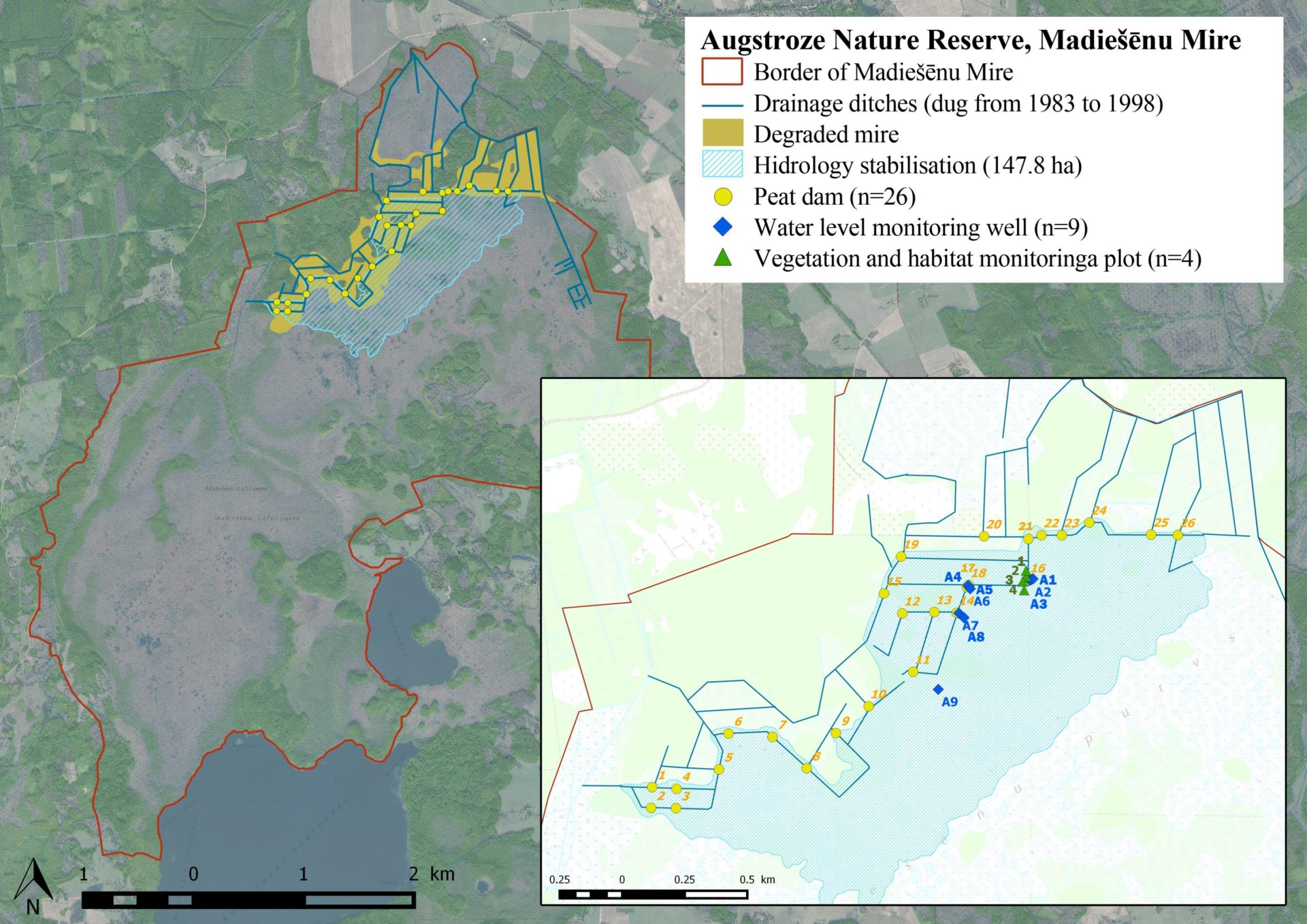
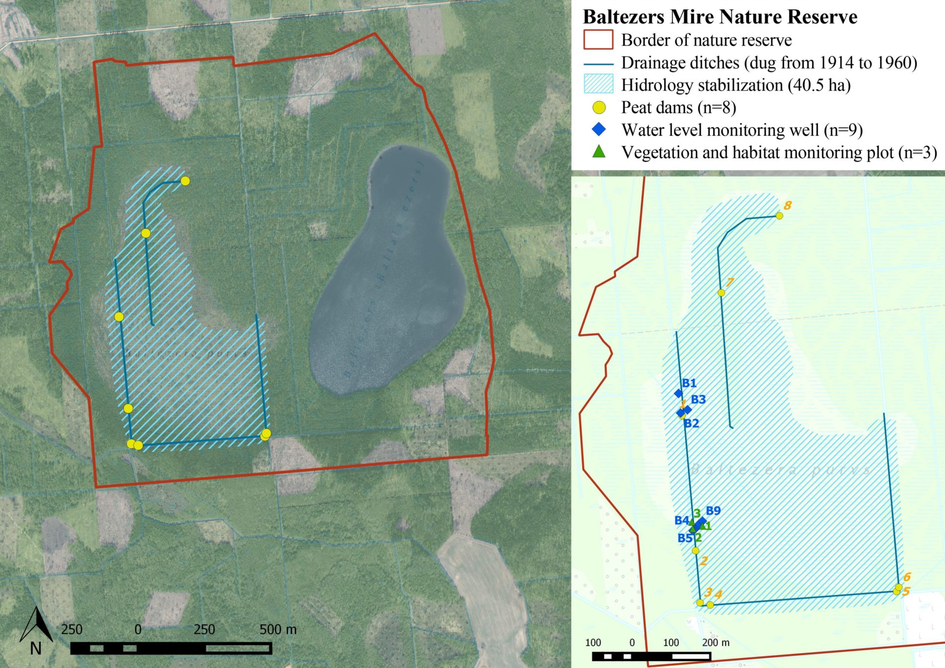
Before dam building, significant water level table fluctuations were observed in wells, in some even by more than 1 m, especially in those located near drainage ditches, e.g. No.5 in Madiešēnu Mire and No.4 in Baltezers Mire. After restoration, fluctuations are still recorded, yet they are shallower than before. A rise of water level in some wells (in Madiešēnu Mire – by 25 cm in one and by 11-15 cm in three others wells, in Baltezers Mire – by on average 2-6 cm) shows positive tendencies of peat layer to gradually getting moister.
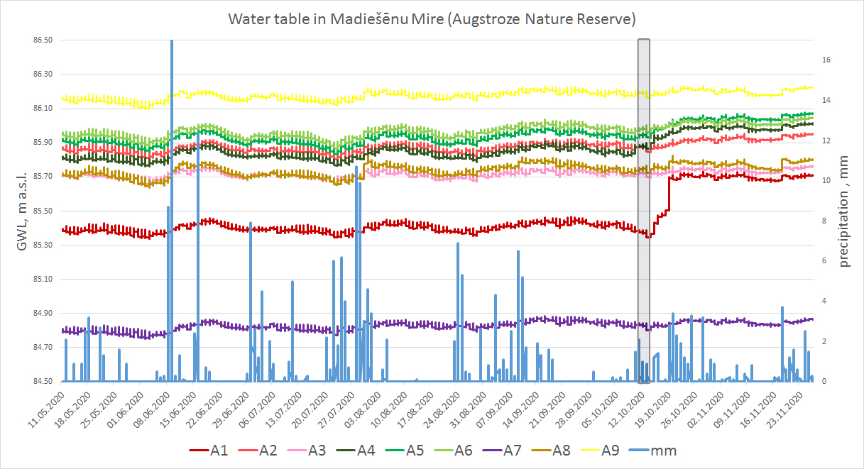
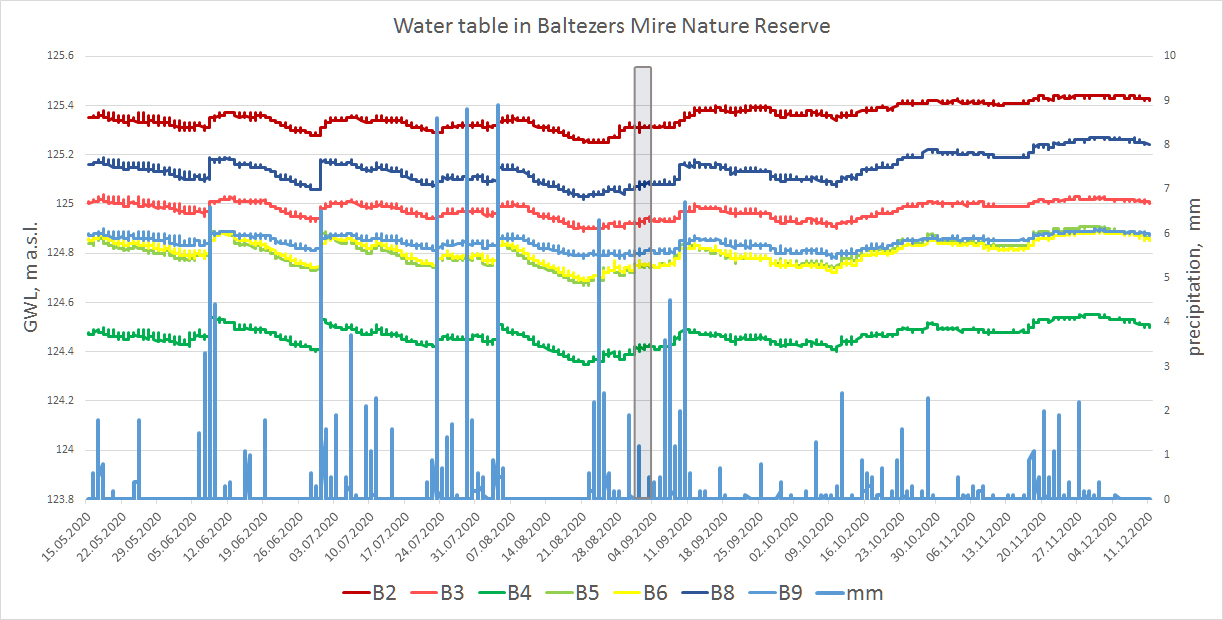
Rapid water table changes are not expected in the restoration area, as there was a relatively high water level in the sites already before. Aim of the peatland restoration is to favour moistening of the top peat layer in the degraded area and avoid creating of open-flooded places. For carbon accumulation, plant photosynthesis and peat formation processes, stable water level is the most important factor, instead of the relative depth of water table. Therefore, after blocking of active drainage ditches and preventing from the water run-off, the natural processes of mires re-establish, plant species return and start to spread again in the degraded area.
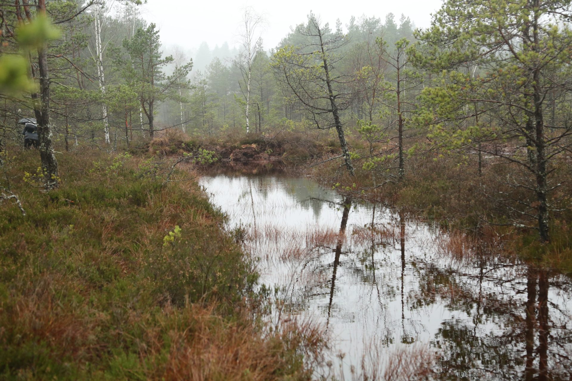
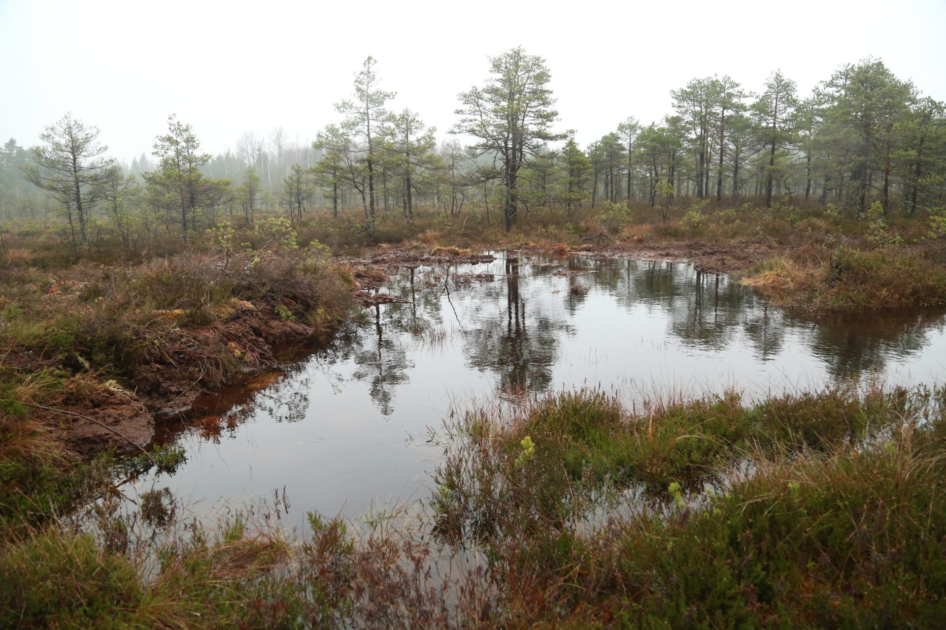
Analysing of restoration success in Engure site is still in process as the area was visited only once, a month after dam building. This time period in this site at the margin of the fen and surrounded by pine forest is insufficient for water level to react to restoration activity on ditches.