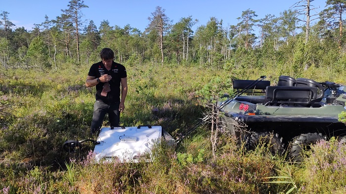
Last week, we started survey of the peat deposit in Suursoo project area using georadar. Georadar is a high-tech apparatus used in geophysics, where the image of the internal structure of the soil is displayed using the pulses of radio waves. In other words, radar allows us to see underground. In the peat deposits of the peatlands, the boundary between the peat and the mineral bed is clearly distinguished, i.e. the thickness of the peat layer can be known, as well as layers with different water content and different degree of decomposition and botanical composition. You can also see the stumps in the peat and the boulders in the bottom layer of the deposit.
The advantage of georadar over drilling a deposit is efficiency and continuous data. However, the interpretation of radar data requires specific knowledge and experience. Our radar expert is Hannes Tõnisson, a senior researcher at the Institute of Ecology in Tallinn University with great experience. As georadar is relatively heavy, we use an 8-wheel off-road vehicle to tow it.
Georadar surveys are needed in the Life Peat Restore project area to gain a better knowledge of the geological structure and development of the restoration area. It helps better to predict the processes that will take place after the restoration of the water regime.
We use two antennas – one for the upper two metres peat (the 300 MHz antenna) and other (70 MHz antenna) for deeper peat. Data with two antennas were collected at the same time.
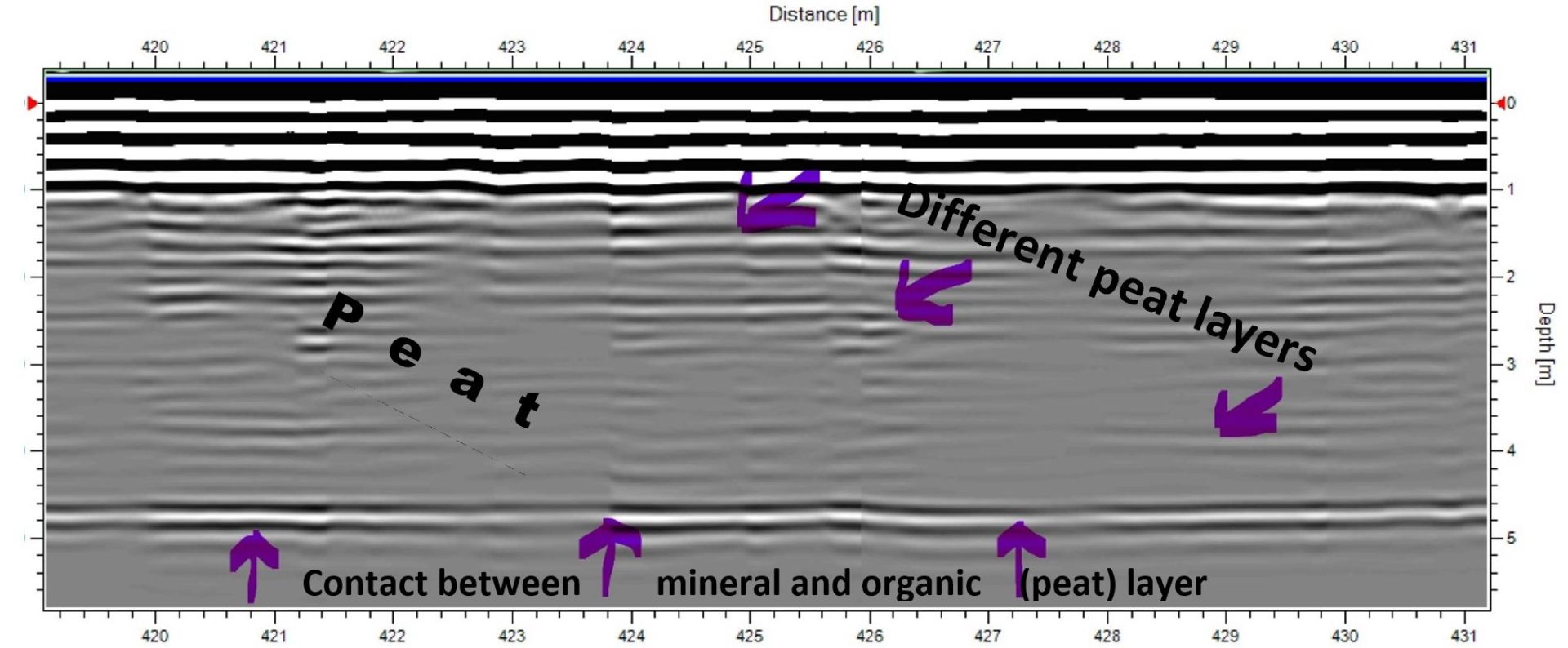
We managed to complete around 5 km of profiles in one day. In most of the studied areas, the depth of the peat is varying between 4-6 meters, deeper in the middle and shallower in the borders. Mineral ground below peat surface is very flat (see the figure). Peat layers with different composition and varying water content are also seen.