Portrait
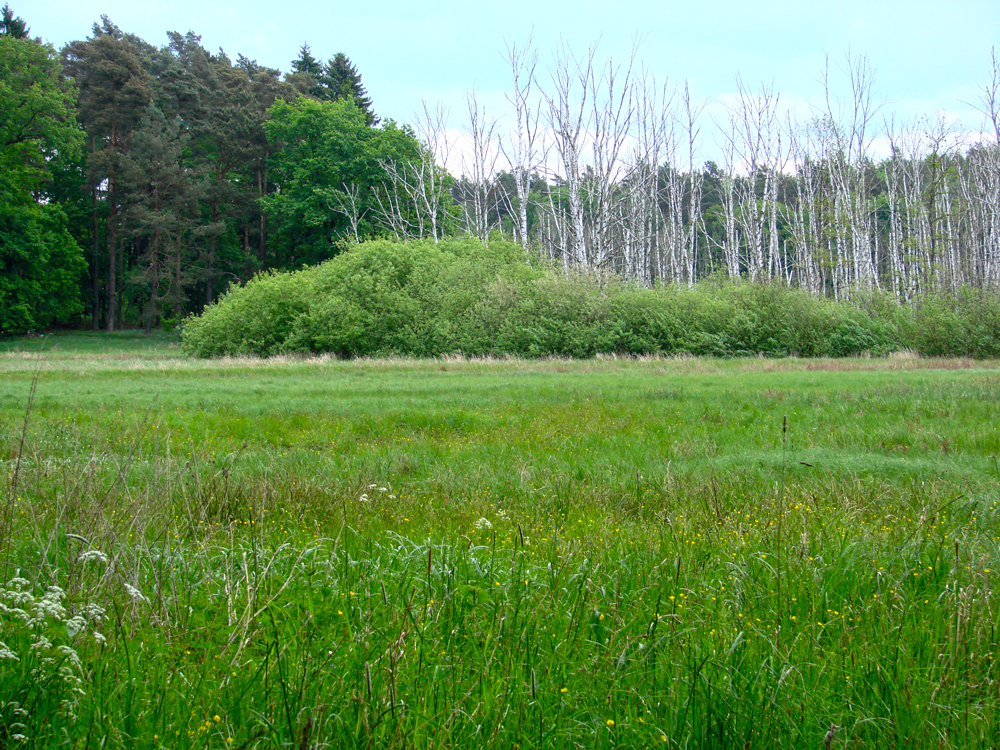
PEATLAND RESTORATION IN THE BIESENTHALER BECKEN
Size: 15,5 hectares
Conservation status: Nature Reserve, NATURA 2000
Habitat types: (Birch-) Bog forest (91D0*)
Climate: Temperate zone
Temperatures: Ø January: -1° C, Ø July: 18° C
Precipitation: Ø 789 mm/year
Peatlands & Greenhouse Gas Emissions
Peatlands
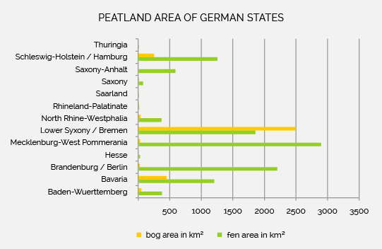
The north and south-eastern regions of Germany are especially covered peatland areas. Although the majority of peatlands are fens, bogs can also be found in the foothills of the Alps and in the north western part of Germany, which are today safeguarded by conservation areas .
Carbon balance and peat usage
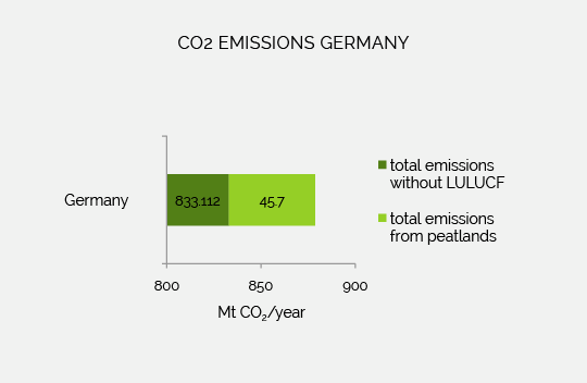
In Germany, around 45 megatons of CO2 equivalents are emitted from bogs every year. This corresponds to about 5.4 percent of the total German greenhouse gas emissions caused by humans (5), making Germany one of the world’s largest CO2-emitter (3). This can also be seen when looking at CO2 emissions per hectare of degraded peatland. Germany, with 0.90 tons, ranks 11th behind Lithuania (4).
Peatland use
Peat from Middle European mires was used since the Bronze Age as fuel. Due to scarcity of wood, the intense use of peat started in the 18th century in Germany, especially in northern Germany. The organic material was also used early on as litter or in agriculture for soil improvement. In the end of the 19th century complex ditch systems were set up to drain the land and make more agricultural area available.
After the Second World War, all available land was put to use, which meant grassland and arable farming on peatlands. The most extensive drainage measures and thus most intensive degradation of peatlands were carried out in the 1960s ( also known as hydromelioration), whereby huge amounts of nutrients and climate damading gases were release into the atmosphere (6).
Current state of peatlands
Today, around 95 percent of peatlands in Germany have been destroyed (1). They were drained mainly for agriculture (~ 86 percent) and forestry on peatlands (~ 10 percent). Further use of the peat through its extraction still takes place even today in raised bogs .
.
Team
-
Letícia Jurema
Letícia Jurema has several years of experience in the coordination of projects for an international environmental organisation. She offers skills as lawyer and environmental policy consultant. She is responsible for the international coordination of the project, public relations and policy related issues. -
Jonathan Etzold
Jonathan Etzold studied Landscape Ecology and Nature Conservation in Greifswald. The last 15 years he was involved in projects on sustainable land use and biodiversity protection, mainly in former Soviet countries. He is responsible for national coordination and analysis of the project’s scientific content. -
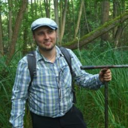
Andreas Herrmann
Andreas Herrmann holds a degree in Geoecology. He previously worked at Humboldt-Universität zu Berlin in the field of peatland-soils and –hydrology, focussing on greenhouse gas dynamics. He is the project’s greenhouse gas measurements expert.
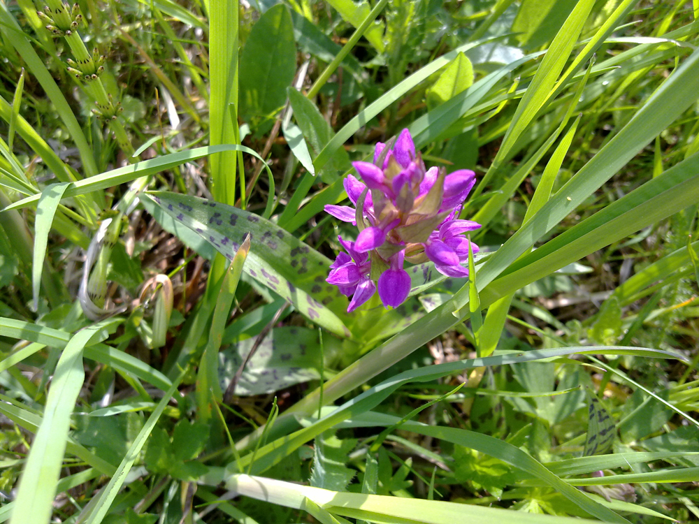
Gallery

Partner & Co-Financer
As responsible, NABU (Nature And Biodiversity Conservation Union) coordinates the LIFE project. The measurements on the project sites in Biesenthaler Becken are realized by the NGO, too.

Founded in 1899, NABU (Nature And Biodiversity Conservation Union) is with 620,000 members and sponsors one of the oldest and largest environment associations in Germany. NABU operates at the national and international level, at which peatland conservation is a meaningful field. In 1908 the first peatland area was bought and since then protected by NABU foundress Lina Hähnle at Federsee in Baden-Württemberg.
With many long lasting projects of the NABU groups and National Associations NABU intensifies it’s efforts to preserve and restore peatlands. Since 2011 restoration measures in more than 12 project areas were financed by the German Peatland Conservation Fund.
By means of the International Peatland Conservation Fund and in cooperation with international partners, pilot projects and innovative approaches for restoration and conservation of peatlands are promoted, like the LIFE Peat Restore project. As the coordinating beneficiary, NABU is responsible for the entire project management.

As a Co-Financer, the Barnim district administration takes part in the implementation of the LIFE Project.
References
- Couwenberg, J & Joosten, H. (2001): Das Beispiel Deutschland. In: Succow, M. & Joosten, H., Landschaftsökologische Moorkunde. Schweizerbart Science Publishers, Stuttgart. p. 409-411.
- FCCC – Framework Convention on Climate Change (2015): National greenhouse gas inventory data for the period 1990-2013, Paris. [Status 19/01/2017]
- Joosten, H. (2010): The Global Peatland CO2 Picture. Peatland status and drainage related emissions in all countries of the world. Wetlands International, Greifswald.
- Joosten, H. (2011): The global peatland CO2 picture. In: Tanneberger, F. & Wichtmann, W. (2011): Carbon credits from peatland rewetting. Climate – biodiversity – land use. Science, policy, implementation and recommendations of a pilot project in Belarus. Stuttgart. pp. 20-30.
- NIR – Nationaler Emissionsbericht (2010): Berechnung der Emissionen aus der deutschen Landwirtschaft – (NIR) 2010 für 2008. [Status: 22/01/2017].
- Succow, M. in: Succow, M. & Joosten, H. (2001): Landschaftsökologische Moorkunde. Schweizerbart Science Publishers, Stuttgart.