Portrait
PEATLAND RESTAURATION IN SUURSOO-LEIDISSOO AREA
Size: 3343 hectares
Conservation status: NATURA 2000, SPA, Läänemaa-Suursoo Landscape Protection Area
Habitat types: Degraded Calcareous fen (7230), Transitional and quaking mires (7140), Active raised bogs (7110*), Bog Forests (91D0*), Fennoscandian deciduous swamp woods (9080*), Western Taïga (9010*)
Climate: Cool temperate climate
Temperatures: Ø January: -3°C, Ø July: 17°C
Precipitation: Ø 696 mm/year
Characteristics
Estonia is situated in the nemoral-submeridional fen and raised bog region. According to Ilomets (2017) the total mire area is 310,000 to 340,000 hectares. Peatlands with more than 30 centimeters depth are covering an area of about 915,000 hectares (1).
Peatland use
Exploitation of mires for agriculture and peat extraction started in the 17th century (4) but intensified by the end of the 19th and the beginning of the 20th century, when over 350,000 hectares of organic and wet mineral soil was drained (Ratt 1985). As the hand-cut ditches were only 50 centimeters deep, the drainage impact was modest (6). After the World War II drainage for agricultural purposes was intensified.
Draining of mires for forestry commenced at the beginning of the 19th century, became more systematic after 1830-1840, but remained at a low level until after World War II. In 1918-1940 forestry accounted for some 15,000 hectares of drained peatlands. After the 1950 there was a significant increase in mire drainage. By 1992 560,000 hectares of peatland forests were drained (Pikk 1997) that makes up to 90 percent of former peatland forests.
Mire conservation
Mire conservation dates back about 100 years ago. Since then several mire reserves have been established. The most comprehensive was the conservation efforts in the 1970s, when 30 mire reserves (largely bogs) with a total area of 122,000 hectares were established. As all fens belonged to the ‘potential amelioration fund’, they were not included except for one – the largest (6,000 hectares) yet undrained fen site, the Avaste fen (Kask 1965).
Considerable parts of the fens disappeared due to economic usage. All together 610–650 x 10³ hectares of Estonian mires (~ 65 percent of the total area) have been strongly affected or destroyed by human activities (6).

Land cover map with tree height classes shows that afforestation started on the most heavily drained ditch banks and expanded towards areas with open fen vegetation. Also, availability of nutrients accelerated (meiotrophication) by drainage, which supports vegetation change – precipitation-fed vegetation and woodlands replaced earlier groundwater-fed fen vegetation. The height of trees (Betula pubescens, Picea abies, Pinus sylvestris) is mainly about 12-17 meters, partly up to 20-25 meters
Peatlands & Greenhouse gas emissions
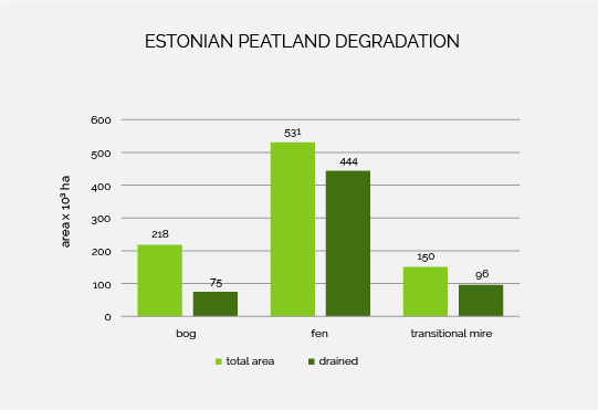
Nowadays about 70 percent of Estonian mires are directly or indirectly affected by degradation. About 5000 hectares are abandoned peat mining areas, on 11,000 hectares peat mining is still being in progress (2).
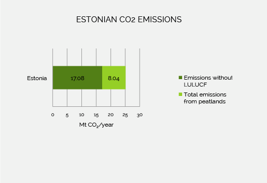
Today about 70 percent of the mires are impacted by drainage, thereof 84 percent of fens and 64 percent of transitional mires. The annual CO2 emissions of Estonian mires are 7.7 megatons CO2 (1 Mt = 1 Mio. t) in which
- 1.5 megatons derive from bogs,
- 1.2 megatons from transitional mires and
- 4.8 megatons from fens (2).
If the CO2 emissions from degraded peatlands are focussed, Estonia is with 2.11 tons behind Indonesia on rank 2 at the global scale (3).
Team
-
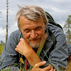
Mati Ilomets
National Coordinator and ecology expert Mati Ilomets has extensive knowledge of telmatology, his work has always been related to mires. -
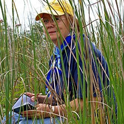
Laimdota Truus
Habitat expert and PR expert Laimdota Truus is plant ecologist with long practice in fieldwork, also an editor of a popular orchid protection journal. -
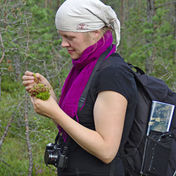
Kairi Sepp
Field and lab assistant Kairi Sepp has experienced in bryophyte ecology and participated in mire vegetation monitoring and inventories. -
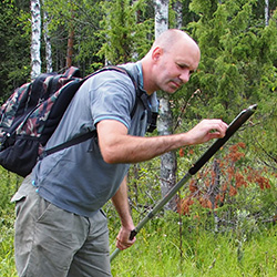
Raimo Pajula
Remote sensing expert and peat expert Raimo Pajula has long experience in peat composition identification and map analyses. -
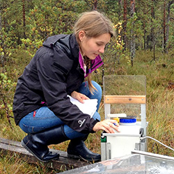
Anna-Helena Purre
Anna-Helena Purre is a Ph.D. student and specialist in the greenhouse gas emission study. -
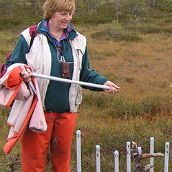
Elve Lode
Elve Lode is a hydrologist specialized in the mire hydrology. -

Martin Küttim
Martin Küttim is a plant ecologist, whos research is currently addressed to the phenology of peatland vegetation and the effect of climate change on peatland ecosystems. -
Galina Kapanen
Galina is a researcher of the water bodies, who has had a great deal of laboratory experience, especially in geochemistry and lithology of sediments investigation, both indoors and in the field. She likes analyzing relations between different things and areas, for example past and present ecosystem processes; last years actively deals with...
Gallery
Partner & Co-Financer
The University of Tallinn has six different schools, with more than 10,000 students enrolled. The Institute of Ecology is part of the School of Natural Sciences and Health. A focus of the work lies on the function and the mass flow in wetland ecosystems. The employees develop research methods and scientific principles for restoring these ecosystems.
The Environmental Investment Centre is the Estonian Co-Financer of the LIFE project.
References
- Paal, J. & Leibak, E. (2011): Estonian Mires: Inventory of habitats. Publication of the project “Estonian mires inventory completion for maintaining biodiversity”. Tartu.
- Barthelmes, A., Couwenberg, J., Risager, M. Tegetmeyer, C. & Joosten, H. (2015): Peatlands and Climate in a Ramsar context. A Nordic-Baltic Perspective. Copenhagen.
- Joosten, H. (2011): The global peatland CO2 picture. In: Tanneberger, F. & Wichtmann, W. (2011): Carbon credits from peatland rewetting. Climate – biodiversity – land use. Science, policy, implementation and recommendations of a pilot project in Belarus. Stuttgart. pp. 20-30.
- Valk, U. (1988): Utilization of peatlands in Estonia: a historical review. Proc. 8th Int.
- Peat Congress, Sect. 1, Leningrad. pp. 78–82.
- Ilomets, M. (2015): Estonia. In: Joosten H., Tanneberger F. & Moen, A. (eds.): Mires and peatlands of Europe: Status, distribution, and nature conservation. Schweizerbart Science Publishers. Stuttgart.
- Kask, M. (1965) – Каск, М. (1965) Растительность болота Авасте в западной Эстонии. [Vegetation of the Avaste mire in West Estonia] Tartu: Akademiya Nauk Estonskoy SSR.
- Pikk, J. (1997): Metsaparanduse tulemused turvasmuldadel. [Results of forest drainage on peat soils] Akadeemilise Metsaseltsi Toimetised, IX. S. 12-16.
- Ratt, A. (1985): Mõnda maaviljeluse arengust Eestis läbi aegade. [About the development of land cultivation in Estonia over centuries] Tallinn: Valgus.


